How Piedmont Road collapsed
- August 16, 2014
- / Shannon Nickinson
- / community-dashboard
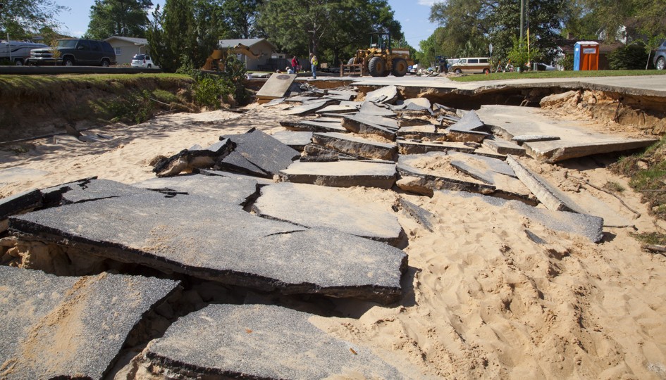
More than 15 inches of rain falling in 12 hours on a highly developed 2,430.74 acre watershed spelled the end of Piedmont Road.
Topography, the size of the watershed and the nature of an historic rainfall were the most significant factors that led to the washout of the road in the Cordova Park neighborhood in the April 29-30 epic rain event.
“(T)he peak hours of the April 2014 storm were nearly a 1,000-year event” that overwhelmed the stormwater system’s capacity, according to a report from Hatch Mott McDonald.
The City of Pensacola paid Hatch Mott McDonald $21,000 to analyze the collapse of Piedmont Road from Summit Boulevard to Tronjo Road in the spring deluge.
The National Weather Service in Mobile data shows that 15.55 inches of rain fell at Pensacola Regional Airport over the course of April 29 -- including 5.68 inches in one hour.
Based on the fact that more than 86 percent of the rain from this storm fell in a 12-hour time frame, “it is believed that this event represented a storm...greater than a 500-year event and likely approaching a 1,000-year event,” the report concludes.
Computer models of what happened
HMM used topographical data and computer modeling to determine if the rainfall exceeded the capacity of the Airport and Cordova Square stormwater ponds.
The modeling predicted that the water level at the Cordova Square pond exceeded its top about 10:20 p.m. on April 29, the report says. Peak water levels at the Cordova pond are predicted to have reached 73.31 feet, 16 inches above the top of the pond.
The Airport pond exceeded its capacity some time after 3:30 a.m. April 30, the report says. Peak water levels at the airport pond are predicted to have reached 74.41 feet, 17 inches above the top of the pond.
“It is important to note that,” the HMM report says, “during a storm of this magnitude, over-topping of a stormwater management facility does not constitute a failure nor does it necessarily indicate improper design, construction, function or maintenance.
“(It) is only indicative of the fact that the facility’s ability to store runoff was exceeded.
“There were no documented structural failures within either the Cordova Square...or Airport stormwater management facility,” the report says.
Piedmont stormwater system
 HMM also reviewed the main stormwater transmission pipe from the Airport pond along Piedmont Road to the outfall at Bayou Texar to evaluate its ability to convey runoff from various storm events.
The modeling focused on the pipe’s ability to handle 24-hour, 15-year, 50-year, and 100-year storm events.
The city requires new stormwater systems to manage runoff from a 25-year storm without more than 4 inches of water being in the roadway. Construction plans for the stormwater system in the Piedmont neighborhood date from Oct. 26, 1959.
Some 480 acres of the Cordova Park area drains into this system.
Models showed the system could handle a 25-year event and a 50-year event, the report says.
The main trunk line and the roadway to the curb line together managed the 100-year storm in models, the report says.
The simulation for the April 2014 event showed that when the trunk line pipes reached maximum capacity, water began to surcharge (come up through storm drains, manhole covers and any other opening it could find) -- between 8:30 and 9:30 p.m. on April 29, before either the Cordova Square or Airport ponds exceeded their banks.
The piping itself, the report says, remained intact throughout the storm.
When the overflow occurred
The overflow from the Cordova Square pond filled a portion of 12th Avenue until it topped the curb. It then went through woods south of the Roger Scott driveway, through the Vickrey Center parking lot, into the dog park and on to Summit Boulevard.
And then down Piedmont Road.
Then the runoff continued down Piedmont, to Tronjo to Bayou Boulevard. Once it pooled and topped the curb there, it flowed into the yards of homes that front Bayou Boulevard, across Gumwood Road to Ironwood Road.
At Ironwood the water flowed behind residences on Palermo Road and Villafane Drive to the intersection with Seville Drive and into Bayou Texar.
The overflow of the Airport pond came out over its lowest point -- along the Airport perimeter road near the clay tennis courts at Roger Scott, around the courts, through the parking lot, where it pooled it topped curb there.
Then that overflow, too, came down Piedmont Road.
On a contour map, Piedmont Road is the floor of a valley through that neighborhood, draining to Bayou Boulevard and ultimately Bayou Texar.
“The natural topography in the area..concentrated those flows along Piedmont Road ultimately resulting in the catastrophic damage which occurred,” the report says.
Read about planned drainage improvements at the Airport pond here.
[progresspromise]
Recent Posts
-
 CivicCon launches with a look at good growth in cities
-
 Building stronger brains one baby, one parent at a time
-
 SCI debuts commercial on Early Learning City
-
 Entrecon: World class speakers and an opportunity to sharpen skills
-
 PYP Quality of Life survey 2017
-
 EntreCon Pensacola 2016: A look back
-
 Leadership tip: getting better employee takeaways
-
 Leadership tip: be interested instead of interesting
-
 Leadership tip: delivering difficult messages
-
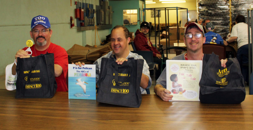 Brain Bags boost Arc, Early Childhood Court programs