Rip current risk high today
- September 2, 2014
- / Shannon Nickinson
- / government
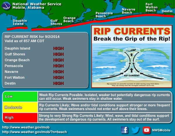
The National Weather Service in Mobile has issued a warning about the high risk of rip currents today through Tuesday evening along the coast.
The risk of rip currents, powerful currents that can pull swimmers out to sea, is very high, according to weather service forecasters. All swimmers are advised to stay out of the Gulf of Mexico today.
Surf is predicted to be 2 to 3 feet high with south winds at 5 to 10 mph.
The weather service also issued a UV index alert. If you are outside where sunscreen or cover up. Minimize your sun exposure between the hours of 10 a.m. and 4 p.m.
The forecast:
— Today: A 20 percent chance of showers and thunderstorms. Mostly sunny, with a high near 89. Southeast wind 5 to 10 mph.
— Tonight: A 20 percent chance of showers and thunderstorms. Partly cloudy, with a low around 79. South wind 5 to 10 mph becoming east after midnight.
— Wednesday: A 30 percent chance of showers and thunderstorms, mainly after 1pm. Mostly sunny, with a high near 88. Northeast wind 5 to 10 mph becoming south in the afternoon.
— Wednesday Night: A 20 percent chance of showers and thunderstorms. Partly cloudy, with a low around 80. South wind 5 to 10 mph becoming east after midnight.
— Thursday: A 30 percent chance of showers and thunderstorms, mainly after 1pm. Mostly sunny, with a high near 88. East wind 5 to 10 mph.
— Thursday Night: A 20 percent chance of showers and thunderstorms. Partly cloudy, with a low around 79. South wind around 10 mph becoming east after midnight.
[progresspromise]
Recent Posts
-
 CivicCon launches with a look at good growth in cities
-
 Building stronger brains one baby, one parent at a time
-
 SCI debuts commercial on Early Learning City
-
 Entrecon: World class speakers and an opportunity to sharpen skills
-
 PYP Quality of Life survey 2017
-
 EntreCon Pensacola 2016: A look back
-
 Leadership tip: getting better employee takeaways
-
 Leadership tip: be interested instead of interesting
-
 Leadership tip: delivering difficult messages
-
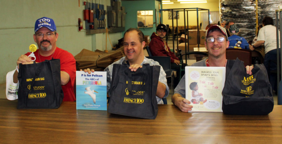 Brain Bags boost Arc, Early Childhood Court programs