Strong storms coming through area
- May 26, 2015
- / Shannon Nickinson
- / community-dashboard
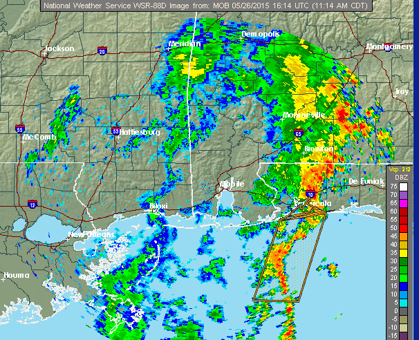
The National Weather Service in Mobile has issued a hazardous weather outlook for our area through today and into tonight.
According to the forecast issued at 6 a.m.:
A well-defined line of showers and thunderstorms are moving across the area today. Although widespread severe weather is not anticipated, gusty, straightline winds, frequent cloud to ground lightning and periods of very heavy rain can be expected with the stronger storms moving through this evening.
Moderate to minor street and small stream flooding will be possible.
Wednesday through Monday, forecasters expect scattered to numerous showers and thunderstorms to linger through midweek and decrease later in the week and into the weekend. Gusty, straight line winds, frequent cloud to ground lightning and periods of very heavy rain will be the main threats.
Follow the Weather Service here.
If you were to fly into or out of Pensacola International Airport today, check your airline's website for updated flight information.
Recent Posts
-
 CivicCon launches with a look at good growth in cities
-
 Building stronger brains one baby, one parent at a time
-
 SCI debuts commercial on Early Learning City
-
 Entrecon: World class speakers and an opportunity to sharpen skills
-
 PYP Quality of Life survey 2017
-
 EntreCon Pensacola 2016: A look back
-
 Leadership tip: getting better employee takeaways
-
 Leadership tip: be interested instead of interesting
-
 Leadership tip: delivering difficult messages
-
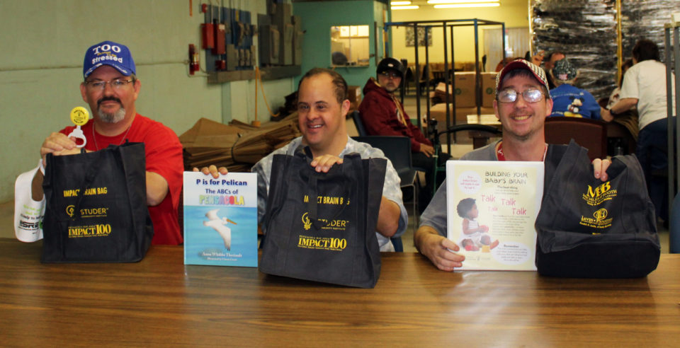 Brain Bags boost Arc, Early Childhood Court programs